Exhibitor’s List

ONESOLUTION
(주)원솔루션컴퍼니
Booth E-D-4CEOil-Kim (김일)
Tel010-2691-9563
Websitehttp://www.onesolution1.com/
Address(08362) 서울 구로구 부광로 96-5 (항동) 에이스캠프지식산업센터 327호
96-5 Bugwang-ro, Guro-gu, Seoul, Republic of Korea
96-5 Bugwang-ro, Guro-gu, Seoul, Republic of Korea
Company Profile
We would like to express our gratitude to our customers who always support 'ONESOLUTION'. We import surveying the EFIX agricultural automatic steering system and provide sales and also after-sales service.
We are currently building a nationwide sales and service network through agricultural machinery sales and repair companies nationwide and are striving to supply automatic steering product that farmers can use conveniently.
We are currently building a nationwide sales and service network through agricultural machinery sales and repair companies nationwide and are striving to supply automatic steering product that farmers can use conveniently.
회사 소개 (KOR)
(주)원솔루션컴퍼니를 항상 성원해 주시는 고객님들께 깊은 감사를 드립니다. 당사는 EFIX(이픽스) 농업 자동조향 시스템, IC100 자동 균평 시스템 및 GNSS 수신기와 같은 측량기기를 수입하여 판매 및 AS를 지원하고 있습니다. 현재 전국 농기계 판매업체 및 수리업체를 통해 전국적인 판매 및 서비스망을 구축하고 있으며, 농업인 분들께서 편리하게 작업하실 수 있는 자동조향 제품을 공급하고자 노력하고 있습니다.
Products 2
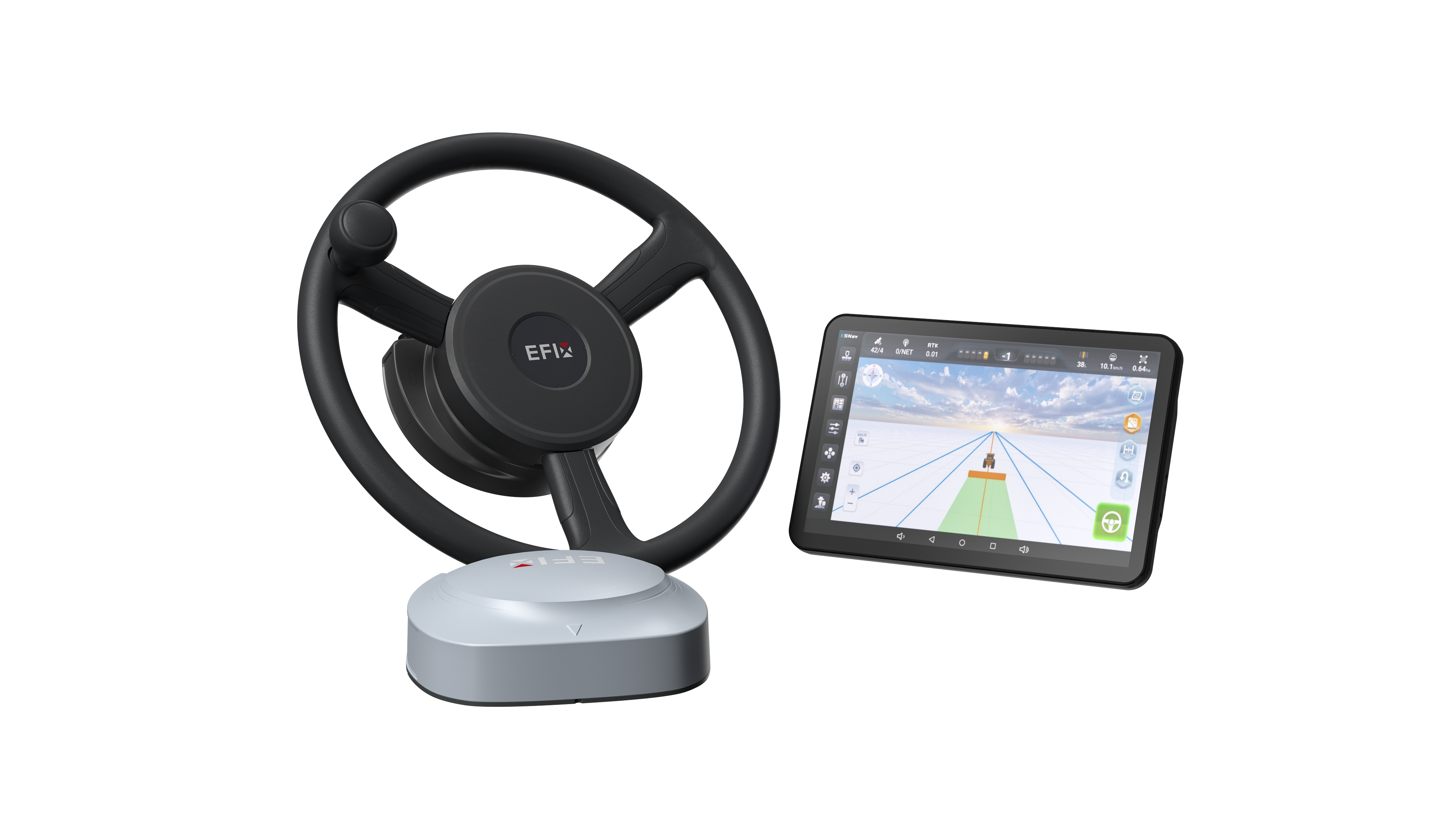
EFIX eSteer20 Auto Steering System
EFIX(이픽스) 농업 자동조향 시스템
EFIX Esteer20 - Precision Agricultural Automatic Steering System
- GPS precision: ±2.5 cm
- Working speed: 0.1 ~ 30 km/h
- Straight line (AB line), Curve line, Path planning line(Point ABCD) and Auto turn
Applicable Operations:
(Tractor) - Rotary work, harrow work, seeding work, spraying work, furrowing work, ridge work.
(Rice Transplanter) - Rice planting work.
- GPS precision: ±2.5 cm
- Working speed: 0.1 ~ 30 km/h
- Straight line (AB line), Curve line, Path planning line(Point ABCD) and Auto turn
Applicable Operations:
(Tractor) - Rotary work, harrow work, seeding work, spraying work, furrowing work, ridge work.
(Rice Transplanter) - Rice planting work.
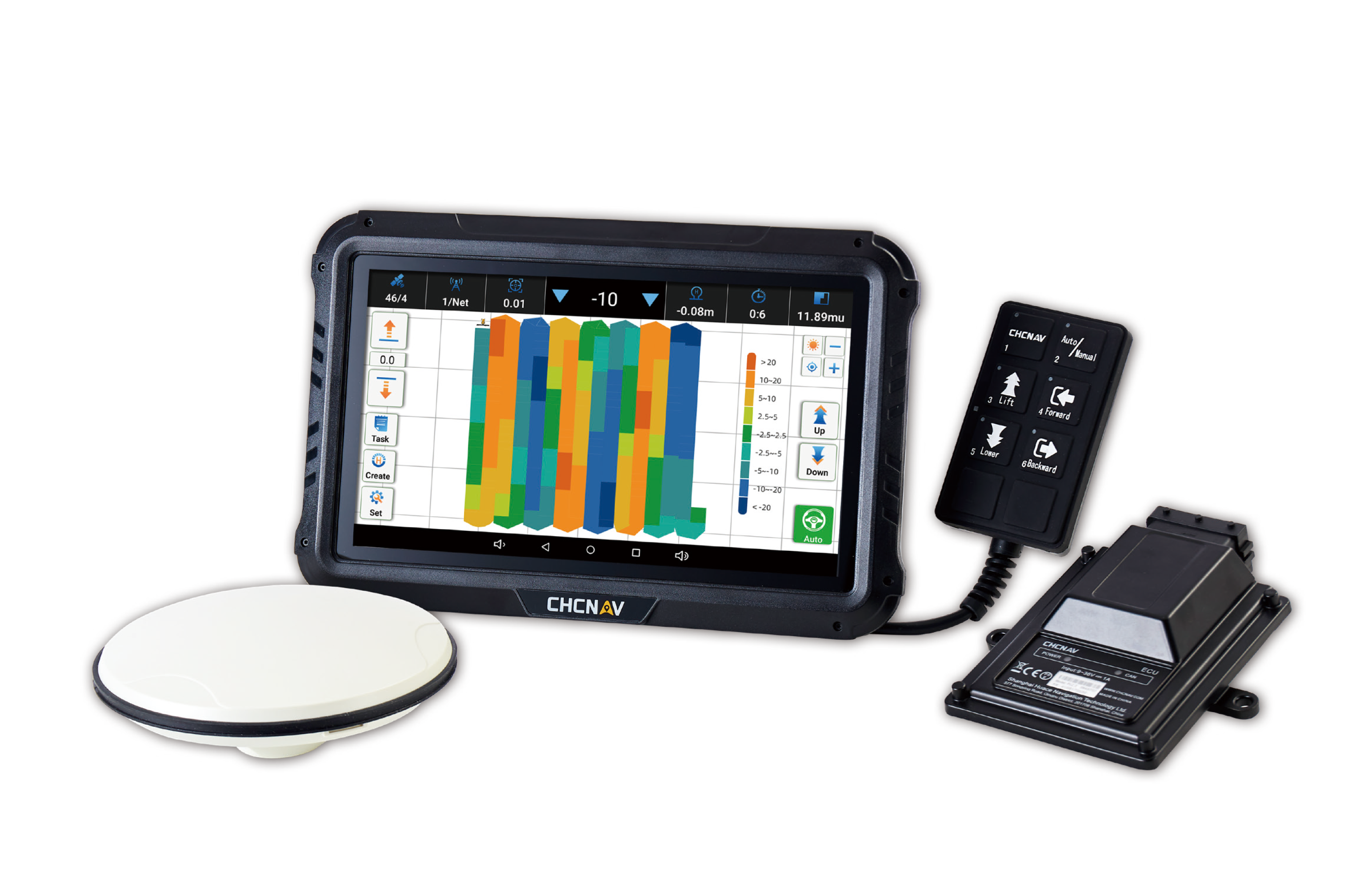
IC100 GNSS Land Leveling System
IC100 자동 균평 시스템
IC100 GNSS Land Leveling System
- GPS precision: ±2 cm
- Applicable Operations: Plowing, Primary and Secondary Rotary Tillage, Harrowing, and Land Grading
The IC100 GNSS Land Leveling is an advanced farm implement control system leveraging the precision of satelite poslitioning technology to automate the leveling of agricultural fields. Through the optimal integration of GNSS RTK technology and electro-hydraulic controls, it measures level changes in real time and automatically adjusts the position of blades and scrapers.
- GPS precision: ±2 cm
- Applicable Operations: Plowing, Primary and Secondary Rotary Tillage, Harrowing, and Land Grading
The IC100 GNSS Land Leveling is an advanced farm implement control system leveraging the precision of satelite poslitioning technology to automate the leveling of agricultural fields. Through the optimal integration of GNSS RTK technology and electro-hydraulic controls, it measures level changes in real time and automatically adjusts the position of blades and scrapers.